Land Cover Classification
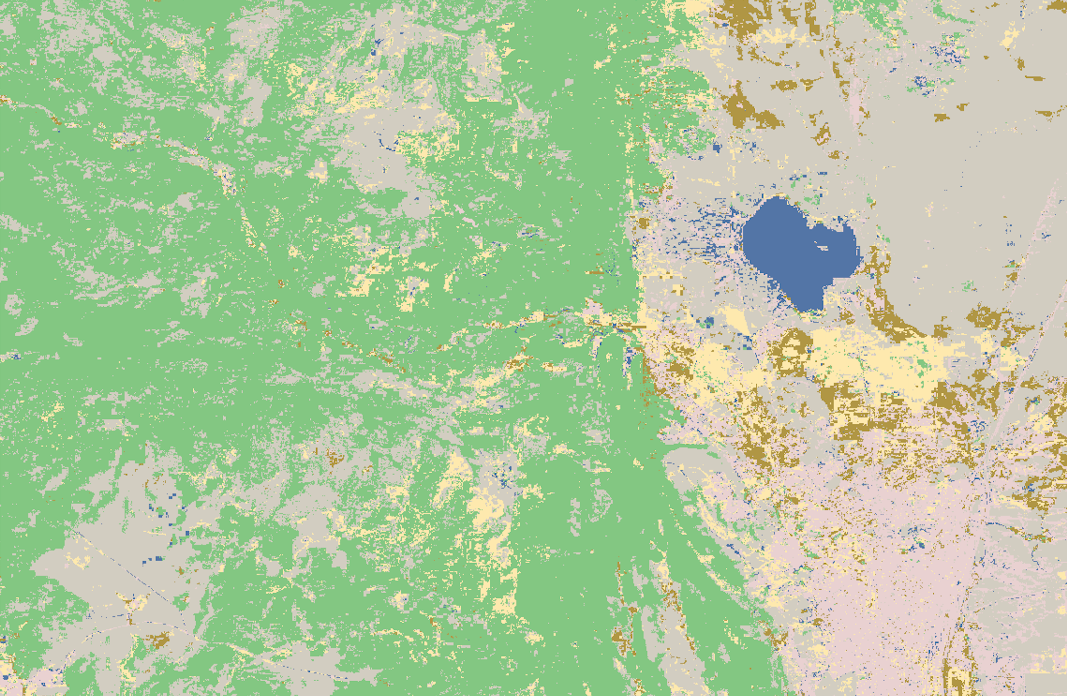
Legend
- Blue = Water
- Pink = Developed
- Grey = Barren
- Green = Forrest
- Brown = Shrubland
- Yellow = Herbaceous
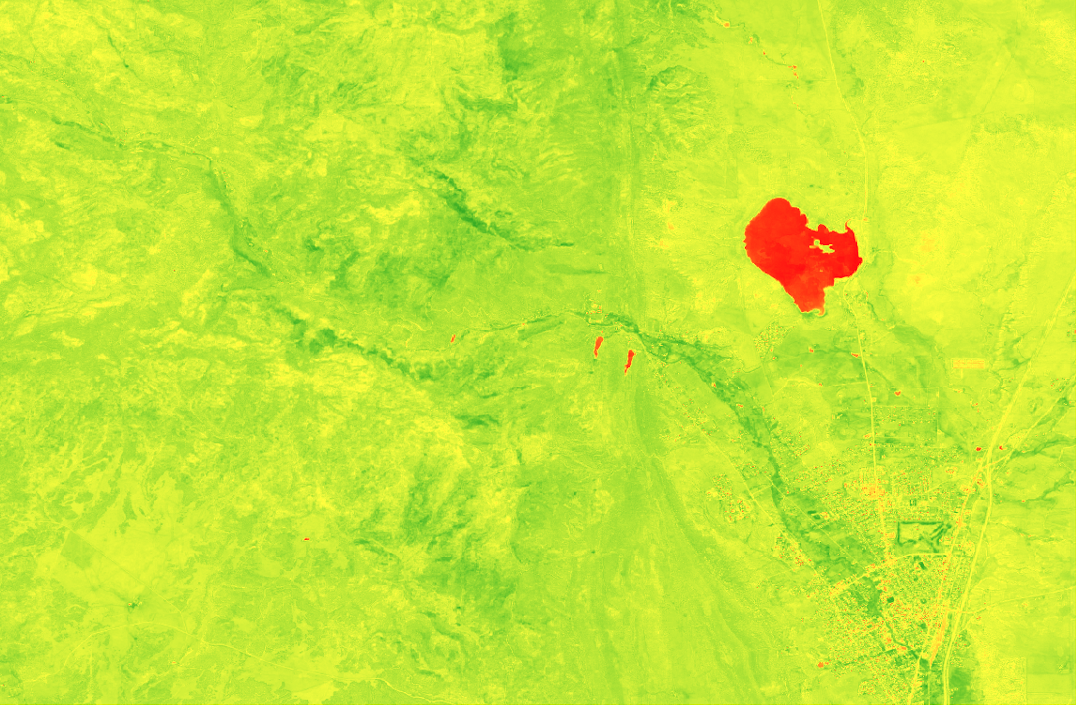
An NDVI (Normalized Difference Vegetation Index) map is a type of remote sensing product that is used to assess and monitor vegetation health, density, and coverage. NDVI is a numerical indicator that utilizes the visible and near-infrared bands of the electromagnetic spectrum to analyze the presence and condition of green vegetation.
In my NDVI map above you can see through the limited amount of drak green areas that the amount of high density and healthy vegetation locations is low, But in general most of the areas do still hold some. This makes sense as New Mexico despite being very sparsely populated with many wild areas is nonthless in a desert climate so vegetation is sparse. The Darker regions in my map coincide with the canyons that have more accsess to water. The water is shown in red.